
Manhattan ZIP Directory Coverage
Official USPS labeling groups four ZIPs with Manhattan: 66502, 66503, 66505, and 66506. Their roles are not interchangeable. Some serve ordinary street delivery, one appears in PO Box and special-mail examples, and one is closely tied to institutional use. The safest Manhattan ZIP code directory describes those postal roles without drawing boundaries that the source does not publish.
| ZIP | Manhattan use | Post office context | Research caution |
|---|---|---|---|
| 66502 | Standard delivery for central and established addresses | Manhattan Post Office, 500 Leavenworth Street, uses 66502-9998 | May also label county or institutional mail; not the city line |
| 66503 | Outer, western, and newer Manhattan delivery examples | Preferred city is Manhattan | Do not assign a neighborhood from the ZIP alone |
| 66505 | PO Box and special mailing use in official local examples | Included in the Manhattan destination group | Not proof that every address is a PO Box |
| 66506 | Institutional and campus-related Manhattan mail | Preferred city is Manhattan | Institutional postal use does not define the campus or city boundary |
The table gives a starting point, not a resident count. USPS does not publish a simple Manhattan resident-directory population table on its lookup page, and county voter statistics do not break residents into these ZIP areas. Verify any single property with exact-address postal lookup and the correct county GIS.
Reading Manhattan ZIP 66502
ZIP 66502 is the familiar Manhattan mailing line for many central and established addresses. The Manhattan Post Office is listed at 500 Leavenworth Street with the 66502-9998 postal code. City and county records also use 66502 as a common mailing ZIP, yet that does not make every 66502 address part of the incorporated city.
Postal geography serves mail delivery. A county office, institution, or rural destination may carry Manhattan as the preferred city even when the parcel lies beyond the municipal line. Search the exact street line in USPS ZIP Lookup, then use Riley or Pottawatomie GIS to identify the parcel and jurisdiction. A 66502 label should never decide which Register of Deeds, district court, or appraiser holds the official file.
The successful USPS research capture explains that ZIP areas and named cities can differ. Read the USPS ZIP Code basics beside the image.
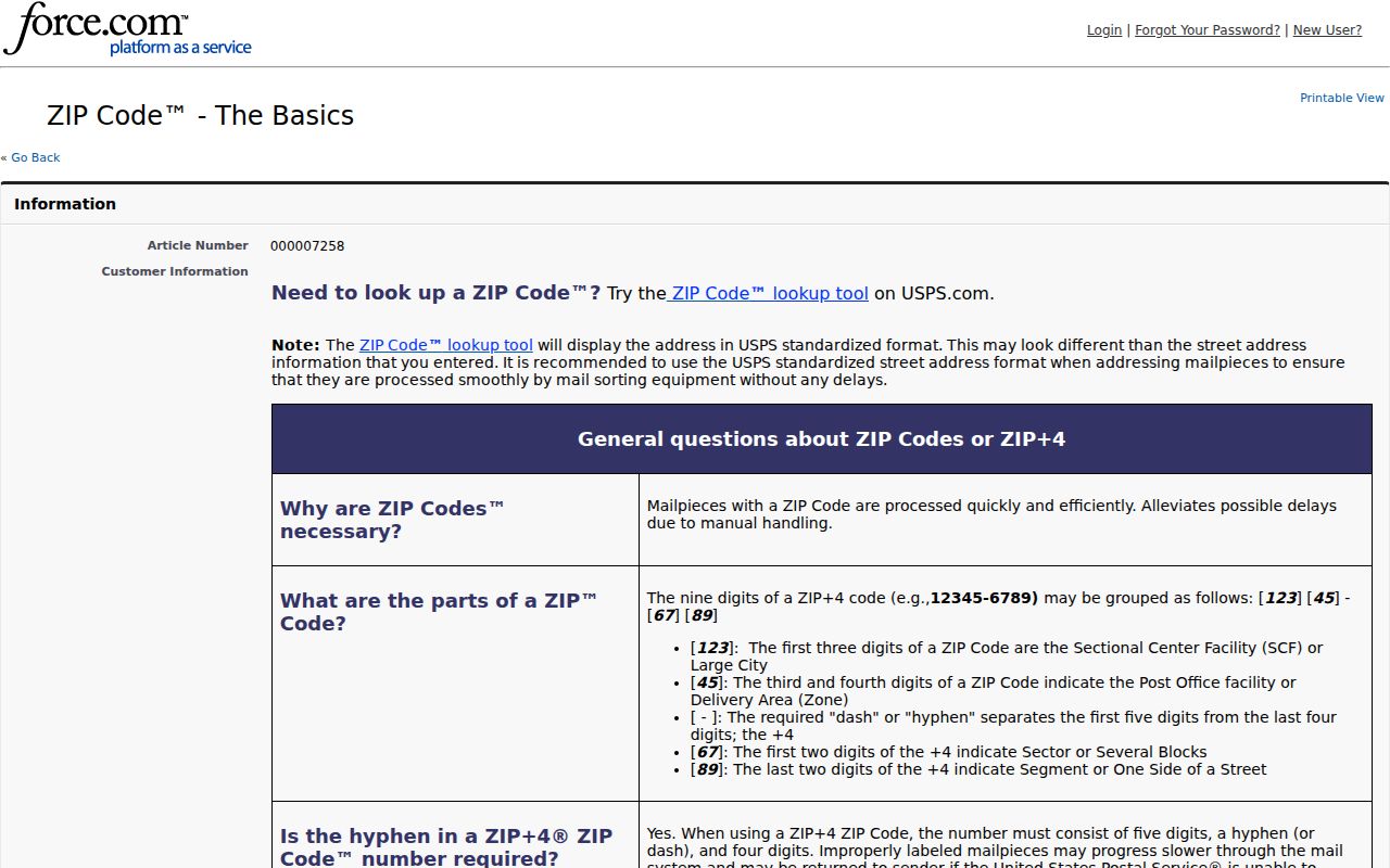
That distinction keeps a Manhattan postal label from being mistaken for a legal city boundary.
Manhattan ZIP 66503 Mismatches
ZIP 66503 appears on outer, western, and newer Manhattan delivery addresses. An official Riley County valuation example shows why one ZIP line is not enough: the parcel's situs address at 1210 Leone Ridge Drive carries 66503, while the owner's mailing address carries 66502. Situs means the physical location of the parcel. The mailing line is where tax notices go. The two can differ without either one being wrong.
This quirk is especially useful when a name search finds an owner but not an occupant. An owner may receive mail elsewhere in Manhattan, another city, or a PO Box. Preserve both fields and their dates. Then retain the legal description, parcel number, and taxing unit, which are better anchors for a deed or assessment search than a ZIP alone.
Key distinction. A 66503 situs line identifies where the parcel sits; a 66502 mailing line identifies where the county sends the owner's notice.
Special Manhattan Postal ZIPs
The 66505 and 66506 entries need restrained wording. Official local material connects 66505 with PO Box and special mailing examples, but the research does not establish that every address in that ZIP is box-only. USPS includes it in the Manhattan destination group. Exact box or street service must be checked with the postal lookup.
ZIP 66506 appears in K-State-related institutional examples. A unique or institutional ZIP can serve one large organization or high-volume destination, but 66506 must not be treated as a drawn campus boundary. Kansas State University is a major Manhattan records source because it creates yearbooks, archives, parcels, directories, and public meeting materials. Its postal code still does not list every person linked to the university.
These special uses show why a Manhattan ZIP code directory is a sorting tool. If a result points to an institution or PO Box, move to the record's named custodian and dated source rather than inferring a private physical address.
Find Manhattan Residents by ZIP
No official local portal documented in the research offers a simple, complete list of all residents in one Manhattan ZIP. USPS confirms the standardized postal line. Riley GIS returns ZIP as a parcel attribute, but its public search is built around parcel, address, street, landmark, subdivision, and Section-Township-Range. Riley tax search documents owner, address, Taxpayer ID, and CAMA fields, not a ZIP filter. VoterView requires one person's exact name and birth date.
- Enter the full address in USPS ZIP Lookup. Record the standardized city, five-digit ZIP, and ZIP+4 when returned.
- Search the exact address in Riley County GIS. If it does not resolve near the county line, repeat in Pottawatomie County GIS or tax search.
- Record the parcel, situs line, mailing line, legal description, and county. Do not merge people just because their mailing ZIP matches.
- Use owner, voter, court, or directory sources only for the named person or parcel. Keep the date and role from each result.
- Once a street is known, use the Manhattan street directory workflow for address-level work.
Large official voter files can be requested by county, district, and party under Kansas law, but the state form does not offer a ZIP selection. Any permitted local filtering happens after receipt and remains subject to redactions, fees, certification, and use limits.
Manhattan ZIP Search Fields
The strongest ZIP-capable source is the postal tool because it answers the narrow question it was built to answer. Property and voter portals must be described by their actual controls. Beacon advertises advanced search, but its live ZIP control was not verified during research, so no ZIP filter should be claimed. The difference between returned attributes and search inputs matters.
| Official portal | Documented input | ZIP behavior |
|---|---|---|
| USPS ZIP Lookup | Street address, or city and state | Returns the standardized ZIP and ZIP+4 for an exact address |
| Riley GIS | Parcel, address, street, landmark, subdivision, S-T-R | ZIP is returned as an attribute; no all-parcels-by-ZIP button documented |
| Riley tax search | Owner, address, Taxpayer ID, CAMA | No documented ZIP field |
| Pottawatomie tax search | Owner, address, street, parcel, CAMA, S-T-R | No observed ZIP field |
| VoterView | First name, last name, date of birth | No ZIP search or ZIP-wide browse |
This field inventory prevents a false promise that the Manhattan ZIP code directory can produce every parcel or voter with one click. A bounded GIS data request may support a ZIP study, but that is different from a public portal button.
Manhattan ZIPs Cross Record Lines
Manhattan is the Riley County seat, yet a small part of the incorporated urban area extends into Pottawatomie County. Postal and city boundaries do not decide which county owns a parcel record. Two nearby Manhattan addresses can therefore require different appraisers, tax searches, deed offices, and district-court clerks. This geography finding is the most important caution in a resident search built from ZIPs.
Start with Riley County GIS. If the parcel lies in the Pottawatomie portion, use the Pottawatomie GIS and its tax system. The successful Pottawatomie tax-search image comes from the county's official search route.
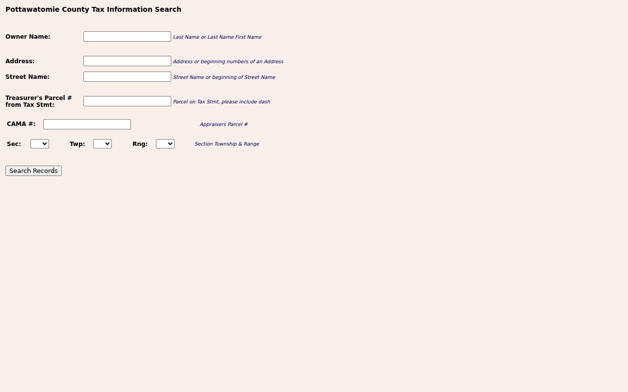
The portal searches owner, address, street, parcel, CAMA, and Section-Township-Range data. Its lack of a documented ZIP field is precisely why the parcel must follow the county map.
Riley land records reach back to 1853, while Pottawatomie's office describes records from 1856. The postal label never replaces either county's official book or current GIS layer.
Decode Manhattan Address Types
A useful Manhattan ZIP code directory keeps four address forms separate. They may point to the same place, but they answer different questions and come from different systems.
- ZIP and ZIP+4
- The five-digit delivery area and the more exact four-digit segment appended by USPS.
- PO Box ZIP
- A postal code used for box delivery; it does not by itself reveal a street location.
- Unique ZIP
- A code assigned to one large institution or high-volume destination.
- Carrier route
- A postal delivery sequence, not a city ward or parcel boundary.
- Situs address
- The physical property location used by the appraiser or GIS.
- Legal description
- The lot, block, subdivision, or metes-and-bounds text used in plats and deeds.
Save the standardized postal line, situs, owner mailing line, legal description, and parcel ID together. The legal description can survive a changed street number, while the mailing address may change without any transfer of the parcel.
Trace Older Manhattan ZIP Addresses
ZIPs are a modern postal layer, while Manhattan's address story is much older. Houses were numbered for free delivery in 1900, and a 1908 correction changed street names and block numbers. One documented example places a former 400 block of Humboldt in what became the 500 block. Fort Riley Boulevard once appeared as Eliza Street, and some old alleys later became Fair Lane or Riley Lane.
When an old address fails, search the former and current street names, both block numbers, the legal description, and a nearby landmark. Pair plats from 1881 or 1909 with Sanborn maps, printed directories, current GIS, and deed books. Annexations also expanded Manhattan through additions such as Grand Mere, Colbert Hills, Sargent, Wyndham Heights, and Meadowland. A historic parcel can fall outside an earlier city line yet inside today's urban postal story.
Note: A ZIP mismatch in an old clipping may reflect later postal standardization, not a false street or a move by the named household.
Manhattan ZIPs and City Limits
A ZIP is a mail-routing area. It is not proof of incorporation, ownership, occupancy, neighborhood membership, county, or school attendance. USPS specifically notes that the named city may differ from the actual municipal location or destination post office. Manhattan's county split makes that warning concrete.
Use USPS for the final standardized mailing line, county GIS for the parcel and jurisdiction, the appraiser or Register of Deeds for ownership, and the appropriate resident record for a named person. Riley voter statistics are county-wide, not ZIP population counts. Marketing neighborhood names also lack the force of city plans, plats, wards, or parcel boundaries.
Boundary check. Never infer a person's home or protected location from a shared ZIP, blank field, institutional code, PO Box, or nearby parcel.
That division of labor is the reliable end point: postal tools route mail, GIS locates land, and public records document specific roles at specific dates.